


Environmental, Hydrogeological and Territorial Consulting for Project Development
We conduct technical studies and support permit applications before SETENA, Dirección de Agua, SENARA, AyA, the Ministry of Health and other public institutions throughout Costa Rica.
We integrate environmental expertise, water resources, geology, mapping and fieldwork to identify constraints, address requirements and help your project move forward with greater clarity.
Technical Studies, Documentation and Applications to Public Agencies
Geo Costa Rica prepares technical supporting documents, assembles application files, manages procedures within its scope of expertise and assists with follow-up. The relevant authority reviews, evaluates and issues the official decision.
Environmental Approval and Compliance Monitoring
Forms, studies, responses to requests for additional information and monitoring of environmental commitments.
SETENA PROCEDURES
Wells, Water Concessions and Water Bodies
Drilling permits, concessions, technical opinions, works in waterways, discharges, well sealing and procedures under current regulations.
WATER DIRECTORATE
Hydrogeological Assessment and Technical Support
Technical opinions, vulnerability reassessments and related hydrogeological studies.
SENARA PROCEDURES
Drinking Water, Sanitation and Discharges
Water and sanitation availability, exemptions and discharges to sanitary sewer systems.
AyA PROCEDURES
Health and Environmental Requirements
Treatment systems, wastewater disposal, health orders, emergencies and management programs.
MINISTRY OF HEALTH
Mining Permits, Concessions and Management
Mining concessions, publicly owned river channels, crushing and processing plants, and procedures for existing concessions.
GEOLOGY AND MININGFrom Available Water Resources to a Technically Feasible Solution
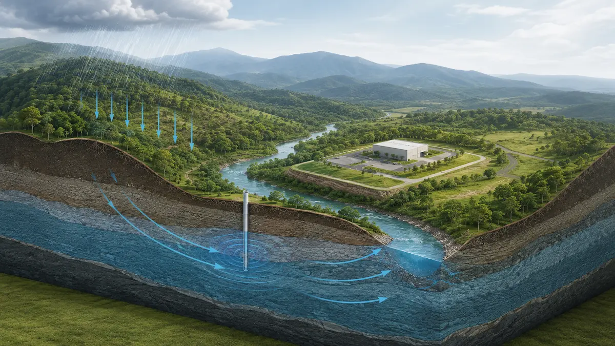
A project's water needs may involve wells, springs, rivers, streams, rainwater, aquifers, water availability, resource protection and administrative procedures.
Geo Costa Rica combines hydrogeology, water resource management, mapping and institutional expertise to understand the project's needs first, and then identify the appropriate source, studies and procedures.
Is There Enough Water for Your Project?
We assess demand, known water sources and alternatives to help determine possible supply options.
Assess Water AvailabilityIs It Worth Considering a New Well?
Geological conditions, nearby wells and hydrogeological information can reduce uncertainty before investing, without guaranteeing a specific yield.
Explore Well DrillingDo You Need a Concession, Protection Measures or a Study?
We assess your case to distinguish between technical evaluation, specialized studies and applications to the competent authority.
Explore Dirección de AguaWhen Can Geo Costa Rica Help You?
The first step is not always a permit application or a specialized study. It is better to understand which questions your project needs to answer and what information is required to move forward confidently.
I Want to Know What I Am Really Buying
We review restrictions, natural hazards, water resources, geology, territorial context and other factors that may affect how a property can be used.
Assess a PropertyI Need to Understand Where and How the Project Can Be Developed
We combine environmental, water, geological, hazard and mapping data to identify constraints before defining structures, access, water supply or site layout.
Assess Site ConstraintsI Want to Reduce Uncertainty Before Commissioning Studies or Construction
An initial assessment helps distinguish which issues justify specialized investigation and which can first be addressed through territorial analysis, mapping and fieldwork.
Explore Our CapabilitiesI Need to Understand What the Authority Requires and How to Respond
Geo Costa Rica reviews your case, prepares technical supporting documents, coordinates studies when needed and assists with procedures before SETENA, Dirección de Agua, SENARA, AyA and the Ministry of Health.
Explore Permits and ProceduresMapping, Hydrogeology and Spatial Analysis Applied to Your Project
Geo Costa Rica transforms field data, official information and spatial analysis into maps and models that reveal relationships not always directly visible on the ground.
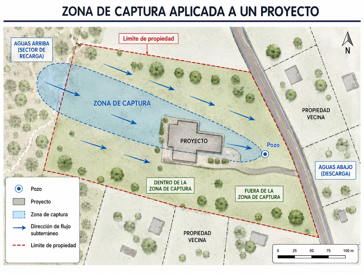
Which Way Does Groundwater Move Beneath the Property?
Piezometric levels, geology and water abstraction points help interpret flow direction and its relationship with wells, activities and projects.
Explore Hydrogeology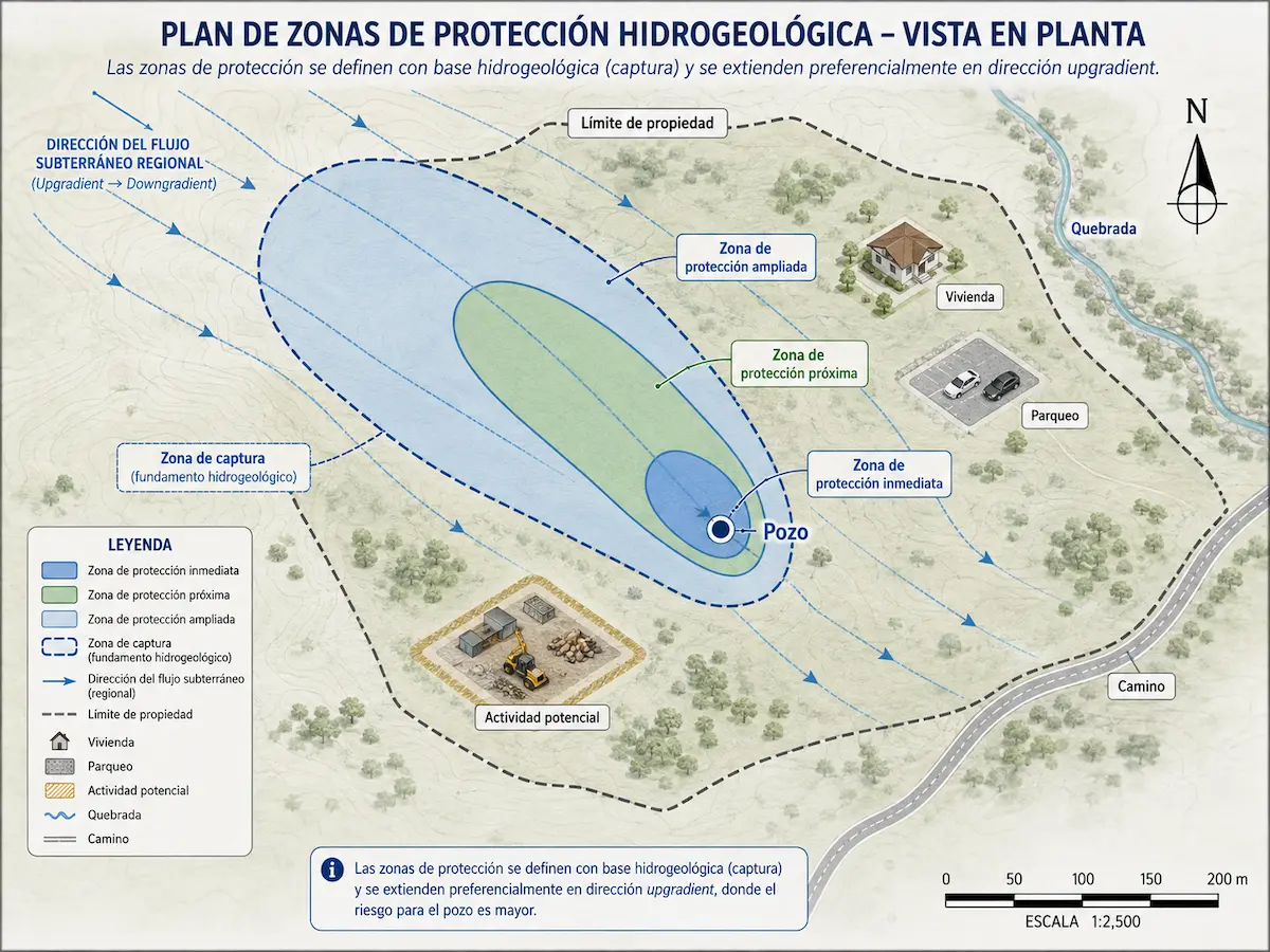
Which Activities Could Affect a Water Intake?
Hydrogeology links capture zones, groundwater flow and nearby activities to assess the protection of wells and springs.
Explore Aquifer Protection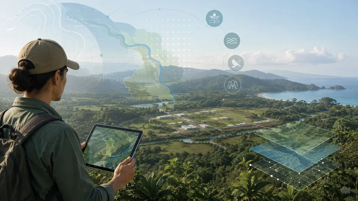
Spatial Information for Real-World Decisions
Mapping, official data, georeferenced surveys and field observations are combined to understand a property within its territorial setting.
Explore Mapping ServicesTechnical Solutions to Understand the Land and Guide Your Project
Geo Costa Rica combines disciplines when a decision requires viewing the project as a system rather than an isolated collection of studies.
Environmental Assessment and Management
Land feasibility, environmental constraints, special requirements and support for early decisions.
Explore Environmental SolutionsHydrogeology and Aquifers
Wells, groundwater flow, aquifer protection, vulnerability, contamination, saltwater intrusion and monitoring.
Explore HydrogeologyGeology, Soils and Geotechnics
Site characterization, subsurface investigations, geological studies, testing and geotechnical support.
Explore Geology and SoilsWater Resource Development
Water needs, sources, availability, new wells, existing abstraction points and supply alternatives.
Explore Water ResourcesNatural Hazards
Flooding, slopes, mass movements, faulting and other hazards assessed at the property and project scales.
Assess Natural HazardsMapping and Territorial Management
Property assessment, spatial analysis, comparison of alternatives, georeferencing and decision-support information.
Explore MappingFieldwork, Mapping and Technical Expertise Throughout Costa Rica
Geo Costa Rica is a Costa Rican firm that integrates environmental consulting, geology, hydrogeology and territorial analysis for public and private projects.
Since 2016, we have worked on properties and projects in different regions of the country, combining existing information, Geographic Information Systems, fieldwork and institutional knowledge.
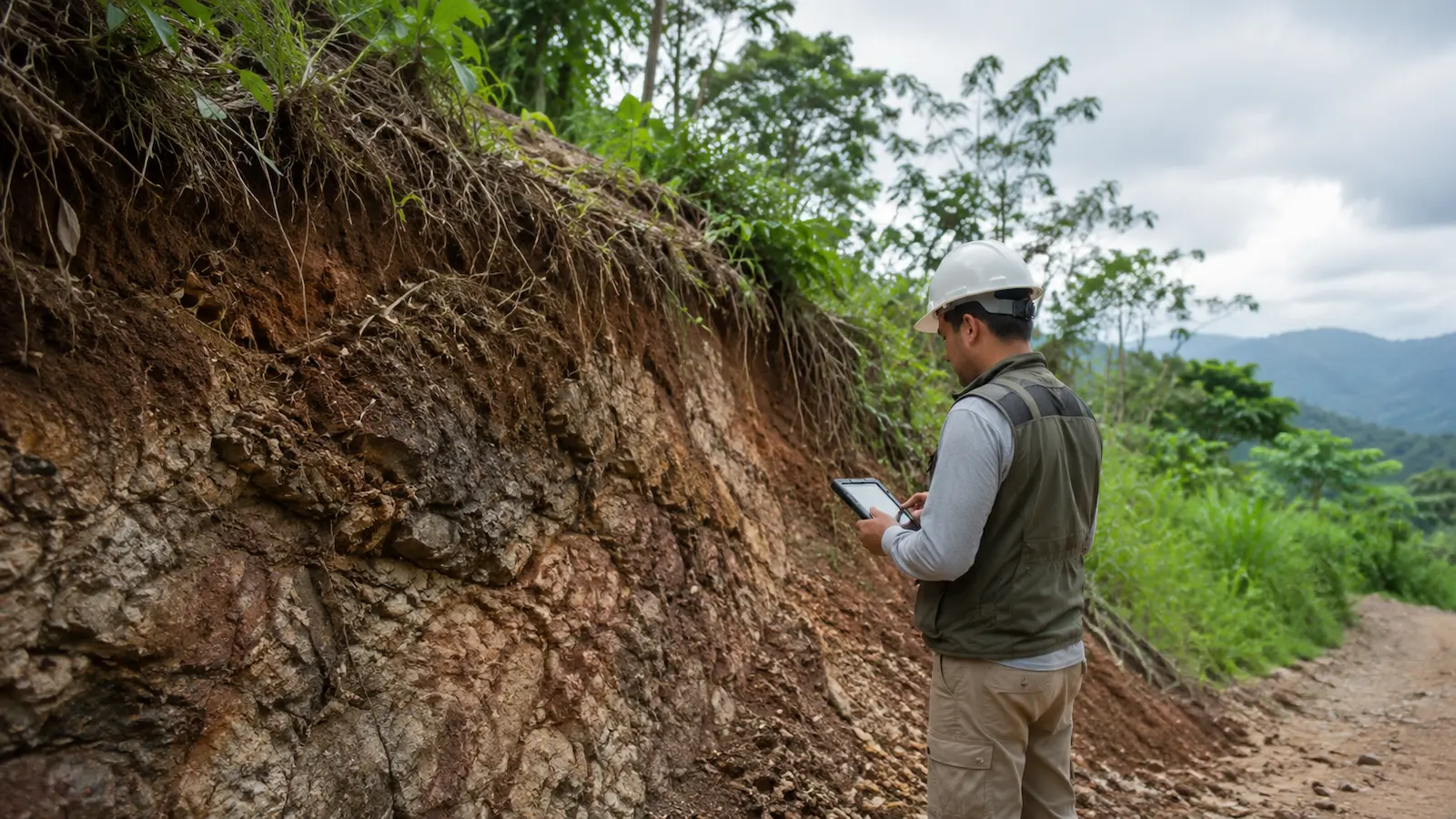
Our work does not end with producing a map or report: we seek to turn technical information into decisions, resolve uncertainties and help projects progress to the next stage.
What Do You Need to Resolve?
You do not need to know the name of the permit, form or study in advance. Tell us what is happening with the property or project, and we can help you identify the next step.
I Want to Buy or Develop a Property
Assess restrictions, natural hazards, water and site conditions.
Explore Environmental FeasibilityThere Is a Spring, River, Stream or Restriction
Determine its location, implications and potentially applicable procedures.
Assess Environmental ConstraintsI Am Concerned About Flooding, Slopes or Faulting
Move beyond regional maps to a site-specific assessment.
Assess Natural HazardsI Need to Drill a Well
Initial assessment, permits, hydrogeology and process coordination.
Explore Well DrillingSETENA Has Requested Additional Information
Review the official notice, identify requirements and prepare a response.
Review My SETENA CaseI Have an Application or Case File and Do Not Know What Comes Next
Identify the responsible authority, procedure and applicable technical support.
Find the Right ProcedureEnvironmental and Geological Due Diligence for Land in Costa Rica
Geo Costa Rica's Land Environmental Feasibility Assessment serves as technical due diligence before buying, designing or committing an investment in a property.
We analyze environmental restrictions, rivers and springs, natural hazards, terrain, geology, water availability, access and territorial information to understand how site conditions may affect the project.
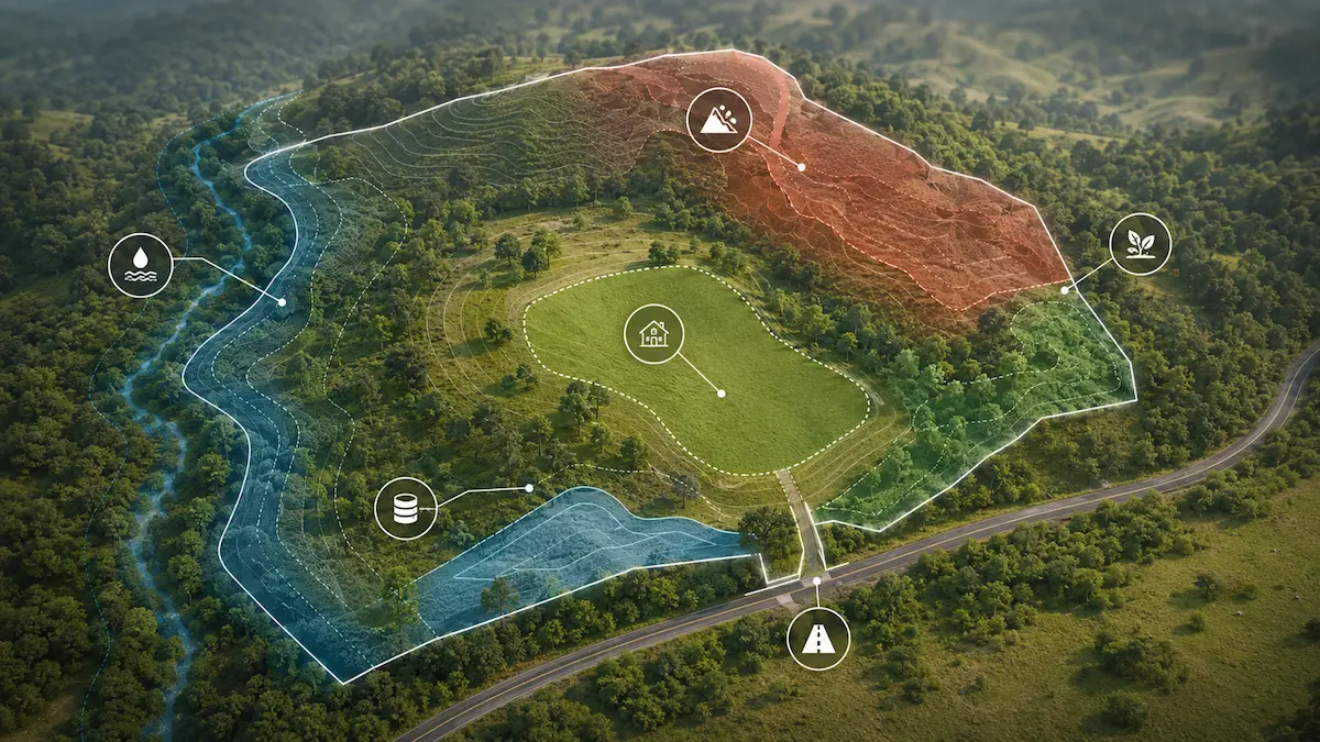
The goal is not simply to identify problems. The assessment translates site conditions into useful information for deciding whether to buy, how a project could be developed, which issues need further investigation and what steps should follow.
How Geo Costa Rica Can Help
What Does Geo Costa Rica Do?
Geo Costa Rica provides environmental, geological, hydrogeological and territorial consulting. We assess properties and projects, carry out technical studies, prepare maps and documentation, and assist with institutional procedures.
Can You Assess a Property Before I Buy It?
Yes. Our Land Environmental Feasibility Assessment provides technical due diligence to identify restrictions, hazards, water-related issues, geology and uncertainties before purchasing or investing.
How Do I Know Which Study or Permit My Project Needs?
Geo Costa Rica can first review the location, the proposed project and the issue to be resolved to determine which checks, studies or procedures are genuinely relevant.
Does Geo Costa Rica Work Throughout Costa Rica?
Yes. Geo Costa Rica serves projects in different regions of the country, combining desk studies, mapping, GIS and fieldwork according to project needs.
Does Geo Costa Rica Issue Official Permits or Technical Decisions?
No. Geo Costa Rica prepares studies and documentation, assists with applications and provides follow-up. The competent public authority reviews the submission and issues the corresponding official decision.
Should Every Study Be Completed at the Outset?
Not necessarily. An initial assessment can help determine which specialized studies are truly needed and which issues can first be checked through mapping, existing records and fieldwork.
Need to Know the Cost of Assessing Your Property or Handling a Permit Application?
Send us the project location, the cadastral survey plan if available and a brief description of what you need to resolve. Geo Costa Rica can review the initial information and prepare a service proposal.